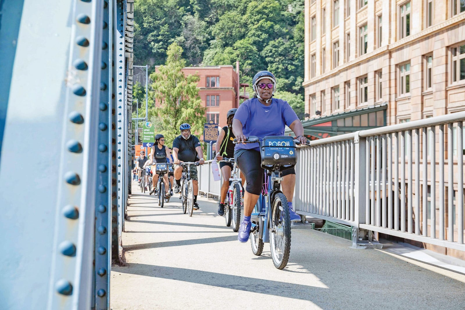
Credit: POGOH
A Bike Network Plan conveys the importance of a safe bike network, the intended outcomes of the network, projected outputs, and a clear decision-making rationale. The plan should demonstrate how improving bike connectivity supports broader city goals, including economic activity and recovery, public health gains, and climate change mitigation and adaptation. Transportation equity should be defined, as well as how biking helps achieve an equitable transportation system.
A city’s Bike Network Plan should be collaboratively created, engaging residents, community groups, city leaders, and staff within relevant agencies in the process. These critical stakeholders should work together to develop a clear process based on trust and transparency with appropriate outreach at each step of finalizing the plan. Adequate resources to develop the plan, including funding for outreach in historically disenfranchised areas and translation or interpretation of materials, must be identified at the outset.
A Bike Network Plan should be a real blueprint that establishes and communicates objectives even through staff turnover or change among elected officials.
City staff charged with developing the plan must engage directly with residents and adapt the plan based on their input. However, plan iterations should not comprise the goal of a connected, safe, and equitable network. Instead, each should refine the routes to reflect important destinations, geography, topography, demographics, data, policies, and history.
A bike network should emphasize connections to everyday destinations: grocery stores, parks, schools, and other places identified as important to residents. First, work with community members to identify where people are and where they need to go. Then, layer where existing network links exist and, importantly, where there are gaps or barriers. A mature bike network will eventually cover the entire city across a variety of streets and bike facilities.
When planning a bike network, it is vital to collaborate with the area’s transit agency and its services. Together, transit agencies and city staff can identify opportunities for biking to support transit goals, such as connecting neighborhoods with major rail or bus stations. This process may reveal a need for bike parking or education about taking bikes on transit. The collaboration will also reveal some conflicts between modal needs. While these conflicts may not be resolved within the final network plan, they should be noted and addressed in project design.
In some cities, a series of neighborhood-level network plans may be more effective than a single citywide plan. Doing so allows for targeted engagement within neighborhoods, often an easier level to engage at than citywide. Neighborhood plans can also be prioritized in areas with historic disinvestment or where more community collaboration is warranted. As those neighborhood plans are developed, agency staff must keep in mind how people on bikes will navigate between neighborhoods to reach key destinations or cross difficult barriers, such as rivers or train tracks.
A Bike Network Plan should be a real blueprint that establishes objectives despite staff turnover or election cycles. While cities should be able to rely on their Bike Network Plan to build out a network over an extended period of time, key projects identified in the plan should also be immediately actionable.
Components of a Connected Bike Network
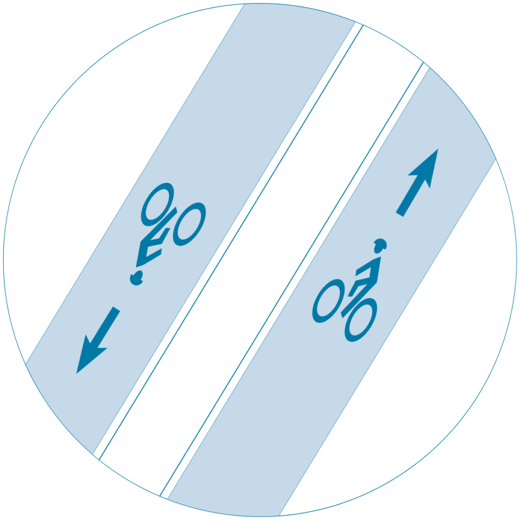
A connected bike network features both principal routes that provide connections between neighborhoods and neighborhood routes that provide connections within neighborhoods and to principal routes. The design tools can vary, but the goal is the same: safe and comfortable All Ages & Abilities bikeways.

Principal Routes
Also known as spines, principal routes are typically connections between multiple neighborhoods that accommodate higher volumes of people biking and facilitate longer bike trips, such as trips to major destinations (e.g., transit stations, job centers, commercial districts). They often cross barriers such as rivers or highways and are as direct a route as is practical without sacrificing safety. Principal routes are the busiest routes in a bike network and should include plenty of space for people to ride on a wide variety of devices moving at varying speeds.1 For example, these routes should allow a caregiver to bike alongside a child while a cargo trike passes by with deliveries. Principal routes must be simple, legible, and easy for residents and visitors alike to navigate.
Plan for safety. Principal routes are often the main way that people access critical destinations across modes, and therefore often serve bus routes or streets with higher motor vehicle volumes. On these routes, cities must provide dedicated space for biking that is separate from fast-moving and turning vehicles. Additionally, cities should recognize malleability in the total volume and speed of motor vehicles. Today’s volumes may not be the same in the future. Vehicle speeds can, and often should, be lowered by designing for and posting a lower speed limit.
Plan for direct routes. Though some people on bikes may be willing to travel out of their way to remain on a safe and comfortable bikeway, that will not be true for all people and will only be true for short detours. In some cities, particularly those with a street grid, a principal bike route might be possible on a slightly less direct route where traffic-calming treatments would allow people on bikes to comfortably travel across neighborhoods. A more direct route may be a good candidate for transit priority measures. If motor vehicle movement precludes an AA&A bikeway alongside transit priority, a less direct principal route for bikes should be identified, designed, and delivered on the same timeline as the transit priority.
Consider maintenance needs early. Similar to high-volume motor vehicle streets, principal bike routes need to be slated for more regular maintenance than neighborhood routes and should be prioritized for snow removal, street sweeping, and repair. If principal bike routes are on streets with lower motor vehicle volumes that might otherwise have lower maintenance standards, increased attention to maintenance should be part of the discussion. (See Maintaining Bikeways.)

Neighborhood Routes
Also known as spurs or local routes, neighborhood routes connect to principal routes for trips within one or across two neighborhoods. Beyond serving people commuting by bike, neighborhood routes are useful for routine errands, such as those visiting shops, schools, parks, and health care clinics.
Connect with principal routes. While principal routes connect major destinations and neighborhoods, neighborhood routes often bring people to their homes, or local parks, shopping areas, and schools. Connections should provide seamless and safe transitions between neighborhood routes and principal routes using high-quality intersection designs and legible wayfinding.
Create density with a network of great neighborhood streets. Plan and design with the expectation that people on bikes will use most of the streets within any given neighborhood. Cities should invest in traffic calming or other treatments that create AA&A conditions for the majority of streets within a neighborhood. Many cities have density targets, such as an AA&A bikeway every 800-1600 feet (250-500 meters).
Reduce motor vehicle speeds and volumes. No matter how short a neighborhood route may be, it needs to have the same safe, comfortable, and well-connected considerations as a principal route. Often, designers can create AA&A conditions by reducing motor vehicle speeds and volumes and prioritizing bike mobility in the same shared space. Add horizontal deflections, such as chicanes, and vertical deflections, such as speed humps, to force motor vehicle drivers to slow down. Consider making operational changes that reduce overall motor vehicle volumes as well, including making streets one-way for vehicle traffic or building diverters. Simply painting shared lane markings is not an effective way to create an AA&A neighborhood route.

Targeted Investments in Connectivity
Connectivity improvements address critical gaps in the current network that prevent comfortable use of an otherwise acceptable route.
Address challenging intersections. The street network in most North American cities includes wide, dangerous arterials that people walking and biking must navigate to move from one neighborhood to another. Intersections and street crossings should be carefully redesigned to enable safe and comfortable access for people biking with minimal delay. For detailed guidance on designing safe intersections, see Designing Safe Intersections.
Create ways to cross physical barriers. Physical barriers, such as bridges without bikeways, limited access roads, rail lines without crossings, or passes between hills, are common gaps in bike networks. Addressing these can be challenging since doing so often involves coordination with other local agencies, state highway departments, or even federal agencies and private railway companies. However, these critical gaps are often the difference between connected networks and disconnected networks, and thus imperative to resolve.
Address needs outside the bikeways. Bike Network Plans should identify specific interventions that improve safety and connectivity for people using the bike network. These could include improvements to bike ramps for off-street paths that transition to on-street bikeways; signage acknowledging the presence of people biking on trails or roads in parks; easy-to-find bike parking; and targeted investments in accessible ramps or elevators at stairs. Consider partnerships with the transit agency to improve bike access on buses, ferries, and trains, and at transit stations.
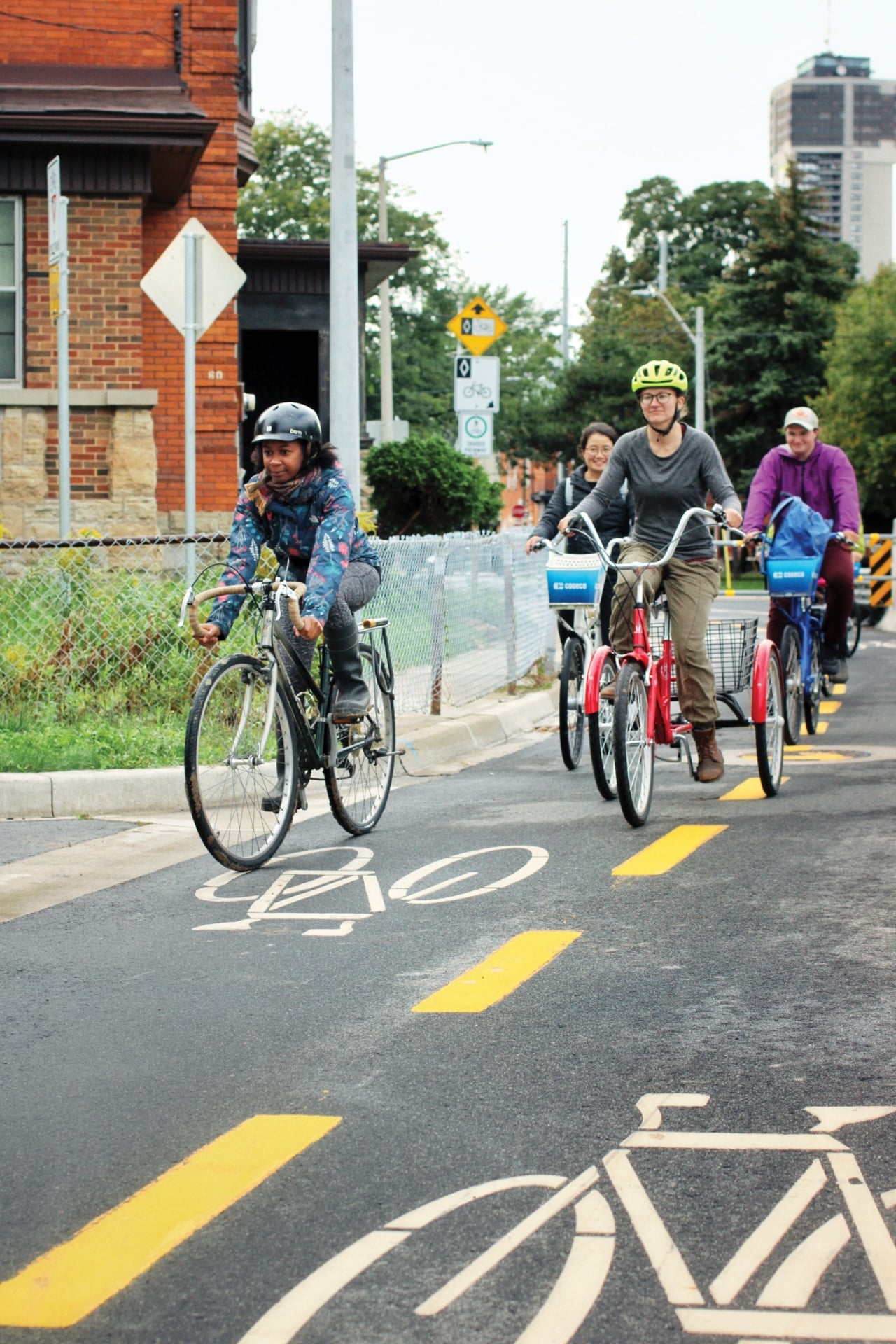
Credit: City of Hamilton
- National Association of City Transportation Officials. Designing For Small Things With Wheels. NACTO, 2023. ↩︎