Three basic street environments are discussed in this guide: Neighborhood, Corridor, and Downtown transit streets. Just as each of these contexts has distinct design needs related to its role in the transportation network, each context presents unique challenges to designing for transit.
Infrastructure options for transit stops, lanes, and intersections are affected by the existing design of a street and the types of transit vehicles in use, but priorities in the allocation of space are often defined by factors beyond the transit service or vehicle itself—from the nature of local businesses to the length of blocks.
Techniques that keep local buses prompt on small neighborhood streets are insufficient for downtown streets with multiple types of service, heavy boardings and unpredictable traffic speeds. The mix of walking, bicycling, driving, parking, and staying activities inform design goals, as do the buildings, institutions, and businesses that form the urban character.
This approach to transit design emphasizes the experience of people using and accessing transit and public space, along with the value of time. It treats streets as linear public spaces that support transit by making it both reliable and attractive as a means of urban travel.
Neighborhood Streets
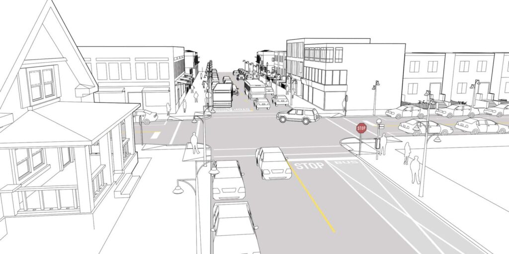
Neighborhood streets, including both mixed-use main streets and residential streets, are both important multi-modal routes as well as urban living spaces. Typically no wider than a lane in each direction, neighborhood streets have moderate pedestrian and bicycle traffic, with low-speed vehicular traffic.1 Local transit has an important relationship with neighborhood streets, which provide all-week demand and ridership. Limited street capacity presents challenges for transit reliability.
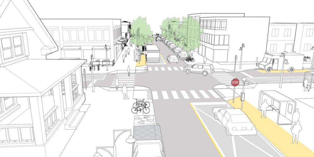
Boarding bulbs and careful curbside management make transit service more reliable without dramatic changes to the street section. On a neighborhood-scale street, improved transit stops provide a significantly better pedestrian realm, and are a focal point for other neighborhood improvements and mobility hubs. Designating space for deliveries and drop-offs, and setting a fair price for curbside parking, relieve common sources of delay for transit and private vehicles alike, and create a safer place to bike as well.
Corridor Streets
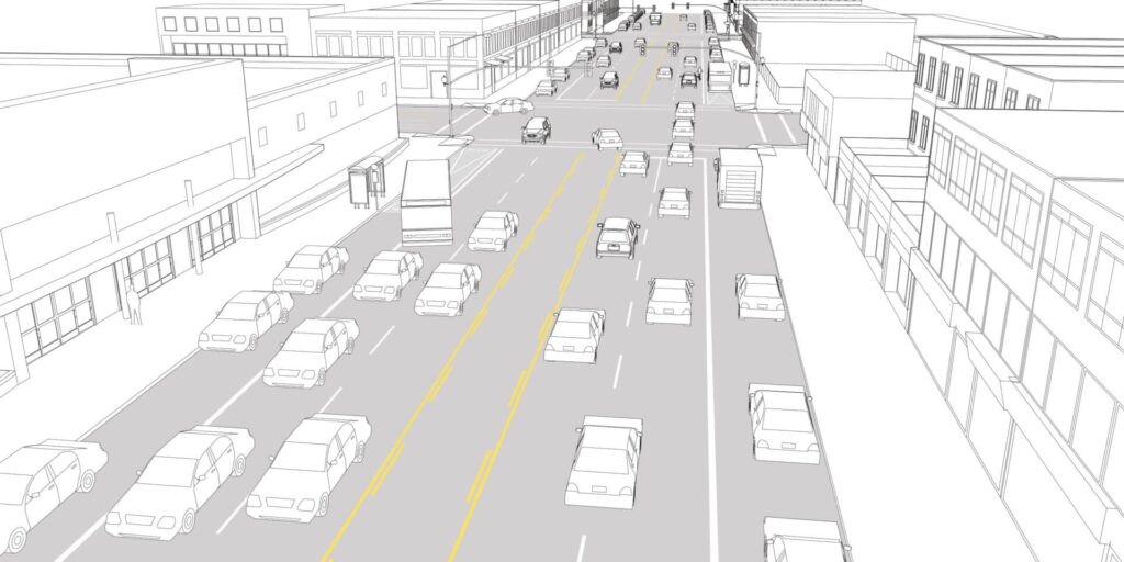
Long and direct, transit corridor streets are critical venues for high-frequency transit service at the center of regional mobility. But these streets have often been designed as highway-like arterials, with minimal or substandard pedestrian and bicycle facilities and high motor vehicle speeds—a high-risk combination. Prioritizing transit throughput and pedestrian safety on these corridors can support higher transit capacity at a citywide level, while attracting local investment.
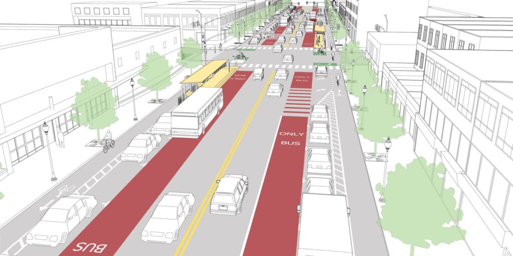
Wide corridor streets are sometimes-overlooked candidates for the assignment of general-traffic lanes to transit, making the street more organized, easier to use, and more predictable, while reducing aggressive driving.2 Providing exclusive spaces for walking, biking, transit, and driving accommodates the different speeds and distinct operational needs of each mode.
Downtown Streets
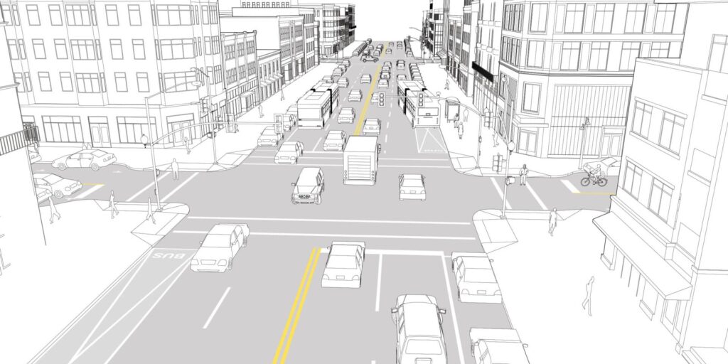
Located in major urban activity centers, downtown streets have high pedestrian and transit volumes due to a high density of nearby destinations like shops, restaurants, offices, and cultural attractions—a concentration of activity only made possible by transit. Separation of transit from general traffic is often necessary to achieve safe and efficient transit performance while supporting pedestrian activity on such vibrant streets
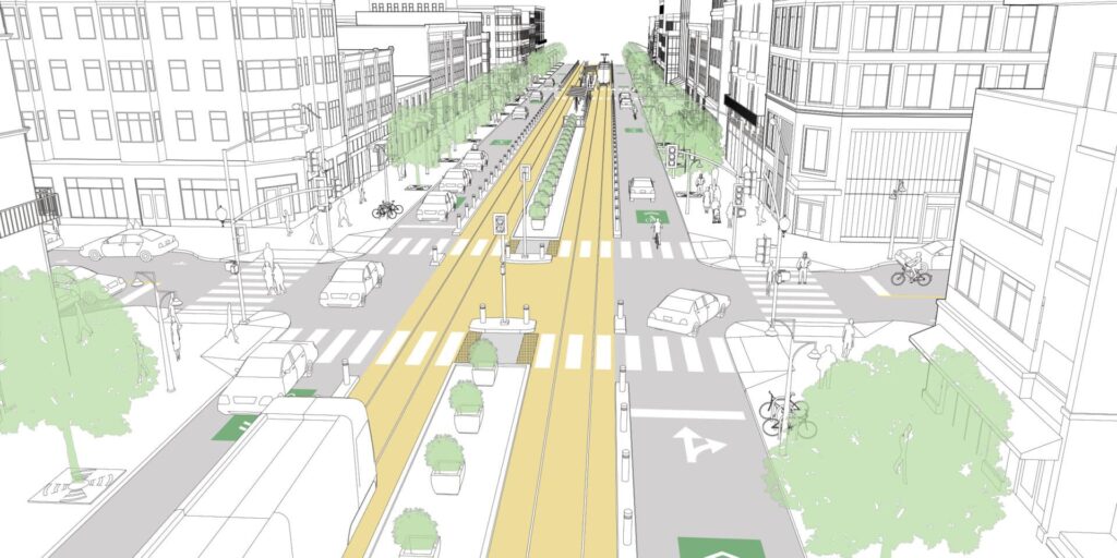
Downtown transit streets can be premier public spaces, and transit reliability is key in an intensively used downtown. Exclusive transit space or space shared with other active modes can create large time savings and radical improvements to the social and economic life of the street.3 Creative use of one-way streets can support a productive transit grid. Transit signal progressions, stations with near-level platforms, longer spacing of stops, and all-door boarding can all speed up the boarding process, benefiting both transit operations and the experience of the street.
- Multi-modal users may compose a larger share of transit riders in the Neighborhood context; quality pedestrian and bicycle infrastructure enhances access and capacity, as transit service is less intense than in Downtown contexts.
Coffell, Kathryn, et al. Guidelines for Providing Access to Public Transportation Stations. TCRP Report 153, Transportation Research Board, Washington, DC: 2012. ↩︎ - Evaluation of Lane Reduction “Road Diet” Measures and Their Effects on Crashes and Injuries. Highway Safety Information System, Federal Highway Administration, Washington, DC: 2010.
Stamatiadis, Nikiforos, and Adam Kirk, Guidelines for Road Diet Conversions. University of Kentucky, Lexington, KY: 2012. ↩︎ - Examples of higher standards for sidewalks include downtown Washington, DC (16 feet + 6-foot buffer), Chicago (varies, 10–12 feet depending upon context), San Francisco (9–17 feet depending upon context), and Boston (varies based on context, but minimum is 7 feet in downtown street types).
Design & Engineering Manual. District Department of Transportation, Washington, DC: 2009.
Boston Complete Streets Design Guide. Boston Transportation Department, Boston, MA: 2013. ↩︎