Description
A bicycle wayfinding system consists of comprehensive signing and/or pavement markings to guide bicyclists to their destinations along preferred bicycle routes. Signs are typically placed at decision points along bicycle routes – typically at the intersection of two or more bikeways and at other key locations leading to and along bicycle routes.
Types of Signs
There are three general types of wayfinding signs:
Confirmation Signs
|
 |
| Purpose |
Information |
Placement |
| Indicate to bicyclists that they are on a designated bikeway. Make motorists aware of the bicycle route. |
Can include destinations and distance/time. Do not include arrows. |
Every ¼ to ½ mile on off-street facilities and every 2 to 3 blocks along bicycle facilities, unless another type of sign is used (e.g., within 150 ft of a turn or decision sign). Should be placed soon after turns to confirm destination(s). Pavement markings can also act as confirmation that a bicyclist is on a preferred route. |
Turn Signs
|
 |
| Purpose |
Information |
Placement |
| Indicate where a bikeway turns from one street onto another street. Can be used with pavement markings. |
Include destinations and arrows. |
Near-side of intersections where bike routes turn (e.g., where the street ceases to be a bicycle route or does not go through). Pavement markings can also indicate the need to turn to the bicyclist. |
Decision Signs
|
 |
| Purpose |
Information |
Placement |
Mark the junction of two or more bikeways.
Inform bicyclists of the designated bike route to access key destinations. |
Destinations and arrows, distances, and travel times are optional but recommended. |
Near-side of intersections in advance of a junction with another bicycle route.
Along a route to indicate a nearby destination. |
Types of Destinations
Wayfinding signs can direct users to a number of different types of destinations, including the following:
- On-street bikeways
- Commercial centers
- Public transit centers and stations
- Schools
- Civic/community destinations
- Local or regional parks and trails
- Hospitals
- Bridges
Prior to developing the wayfinding signage, it can be useful to classify a list of destinations for inclusion on the signs based on their relative importance to users throughout the area. A particular destination’s ranking in the hierarchy can be used to determine the physical distance from which the locations are signed. For example, primary destinations (such as the downtown area) may be included on signage up to five miles away. Secondary destinations (such as a transit station) may be included on signage up to two miles away. Tertiary destinations (such as a park) are more local in nature and may be included on signage up to one mile away. Read More+
Pavement Markings
Pavement markings can be installed to help reinforce routes and directional signage and to provide bicyclist positioning and route branding benefits. Under urban conditions, pavement markings may often be more visible than signs to users of the route. Pavement markings may be especially useful where signs are difficult to see (due to vegetation or parked cars). They can also help bicyclists navigate difficult turns. In the United States, Portland OR, Berkeley CA and Minneapolis MN have experimented with pavement markings. Berkeley and Minneapolis have applied a large stencil taking up nearly the entire travel lane designating the street as a ‘bicycle boulevard.’ In Portland, smaller markings including a small circle and arrow system were initially used; however, since the adoption and wide spread use of the shared lane marking, most bicycle boulevards are being retrofitted with these larger markings. Portland has also applied the shared lane marking as a wayfinding device by turning the chevrons of the marking in the direction of intended travel.
Wayfinding Signage Benefits
- Familiarizes users with the bicycle network.
- Identifys the best routes to destinations.
- Overcomes a “barrier to entry” for infrequent bicyclists.
- Signage that includes mileage and travel time to destinations may help minimize the tendency to overestimate the amount of time it takes to travel by bicycle.
- Visually indicates to motorists that they are driving along a bicycle route and should use caution.
- Passively markets the bicycle network by providing unique and consistent imagery throughout the jurisdiction.
Typical Applications
- Along all streets and/or bicycle facility types that are part of the bicycle network.
- Along corridors with circuitous bikeway facility routes to guide bicyclists to their intended destination.
Design Guidance

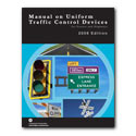
National guidance for bicycle wayfinding signage is found in Chapter 9 of the Manual on Uniform Traffic Control Devices. Some cities, such as Chicago and Berkeley, have developed alternate bicycle wayfinding signage designs.
| Required Features |
 |
Follow MUTCD standards (Section 9B.01 – Application and Placement of Signs), including mounting height and lateral placement from edge of path or roadway. Additional standards and guidance are found in Section 9B.20 – Bicycle Guide Signs. |
Maintenance
Maintenance needs for bicycle wayfinding signs are similar to other signs, and will need periodic replacement due to wear. Cities should maintain comprehensive inventories of the location and age of bicycle wayfinding signs to allow incorporation of bicycle wayfinding signs into any asset management activities. Maintenance for pavement markings are covered under shared lane markings.
Treatment Adoption and Professional Consensus
In the United States, the use of pavement markings to identify bikeways has been experimented with in Portland OR and Berkeley, CA. American cities with some implementation of advanced wayfinding and signing systems include the following:
- Albuquerque, NM
- Baltimore, MD
- Berkeley, CA
- Chicago, IL
- Davis, CA
- Emeryville, CA
- New York, NY
- Oakland, CA
- Portland, OR
- San Francisco, CA
- Seattle, WA
- Washington, DC
- Cambridge, MA
- Austin, TX