Anchorage, Alaska, launched its neighborhood greenway program in 2025 to connect and formalize its existing low-stress network along local streets. In the program’s first year, Anchorage added treatments such as 20 mph speed limits and wayfinding signage to designate 14 miles of neighborhood streets as “neighborhood greenways.”
Neighborhood Greenways
For Anchorage, a neighborhood greenway is a street that prioritizes people walking, biking, and rolling while maintaining access for residential vehicles. The designation is targeted at low-volume, low-speed residential streets that see fewer than 1,000 vehicles per day, where small, low-cost changes such as signage and lane markings alone can have a larger impact than they might on parallel, busier streets.
Whether people choose to bike is heavily influenced by the stresses they anticipate encountering during their trip. These stresses are related to both real and perceived safety and are generally correlated to the speed and volume of motor vehicle traffic on the streets along their route.
These low-speed and low-volume routes for biking and rolling are important for Anchorage’s winters, too. Because trails are not plowed consistently and on-street constrained bike lanes may be covered by heavier snowfall, many residents prefer to use plowed local streets as their primary connections. As the city continues to work on these challenges in the longer term, having a network of on-street, low-stress neighborhood greenways provides an immediate benefit to residents.
The network will connect Anchorage’s multi-use trail system, neighborhoods, parks, schools, and local businesses.
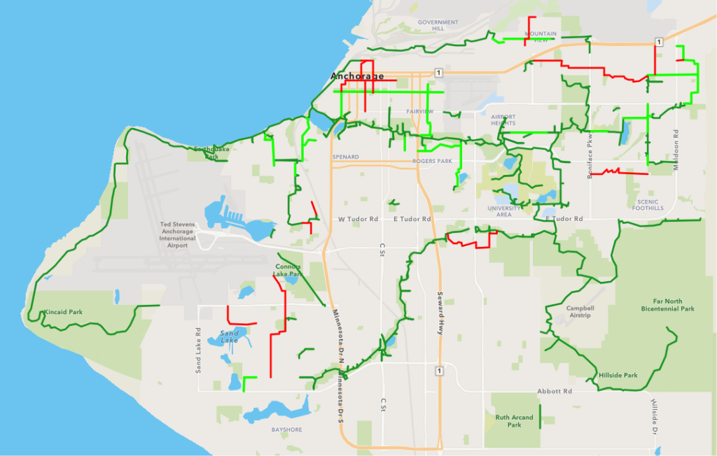
Last year, the municipality focused on formalizing greenways on streets that connect to its over 250 miles of paved multi-use trails. The city began with routes that are already popular with residents due to their comfort and predictability. This year, the city is adding 13 miles of neighborhood greenways, increasing connections to the area’s multi-use path trails and bike network.
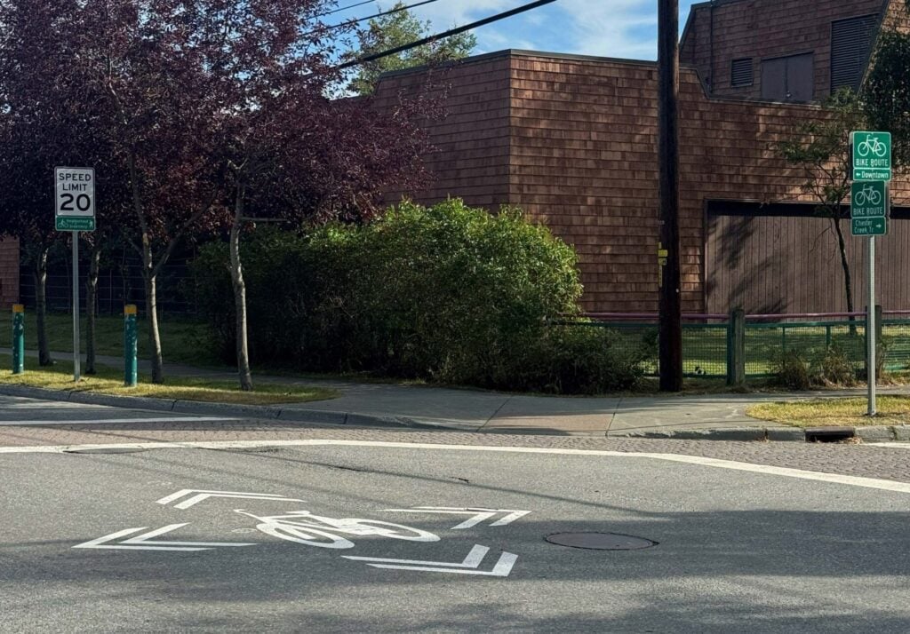
Anchorage uses a number of treatments along greenways to make it clear to vehicle drivers that the street is a shared space. Initial treatments include:
- Shared-lane markings (“sharrows”).
- 20 mph speed limit signs with accompanying “Neighborhood Greenway” plaques.
- Re-oriented stop signs, or new all-way stops at intersections.
- Branded wayfinding signage that directs people to nearby destinations and makes navigation easier for non-motorized users.
Selecting Routes
Ahead of selecting 2026 greenway routes, the city team asked residents for route recommendations, feedback on the routes installed the prior year, and overall thoughts on the plan. Using a survey map, residents could select existing and proposed routes and leave comments or suggest alternatives. This feedback, along with the city’s existing data and internal prioritization criteria, was used to identify the planned greenways.
Ongoing data collection—before and after implementation—will be used to monitor traffic conditions and evaluate the effectiveness of greenway designations.
Expanding the greenway network
Anchorage plans to keep expanding its network of neighborhood greenways—and adding traffic calming treatments to further improve both real and perceived safety. Where capital improvements are programmed on a greenway route, the team will construct traffic-calming treatments, such as traffic diverters, protected crossings at busy intersections, and medians. Any future repaving projects within the greenway network will incorporate and refine greenway treatments to ensure the design continues to support low-volume vehicle traffic and safety for people walking, biking, and rolling.
Resources and Guidance
From Anchorage:
From the NACTO Urban Bikeway Design Guide: