Ponce de Leon Avenue is a major arterial roadway in Atlanta, one of the few east-west corridors in the city, and the main feeder into the Midtown central business district from the east. A Georgia Department of Transportation (GDOT) road also known as US 29/US 78/US 278/SR 8, Ponce de Leon Ave connects Midtown with the Atlanta BeltLine, a 22-mile network of public parks, multi-use trails and transit circling downtown. The corridor is experiencing sustained economic investment, with developments such as the Ponce City Market, the largest adaptive reuse project in Atlanta’s history slated for redevelopment in the coming years.
EXISTING CONDITIONS
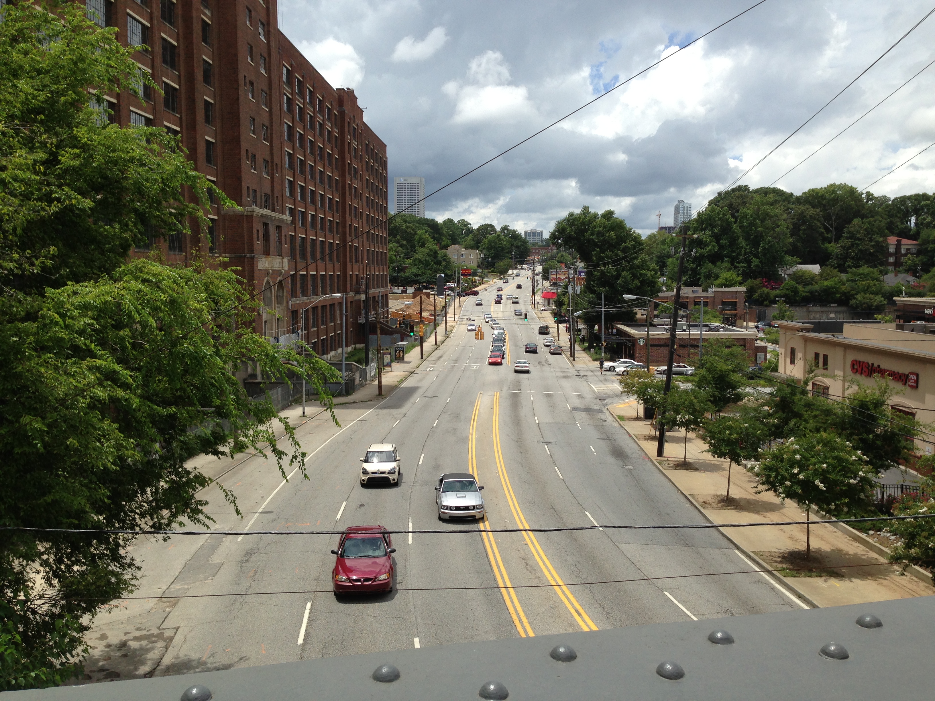
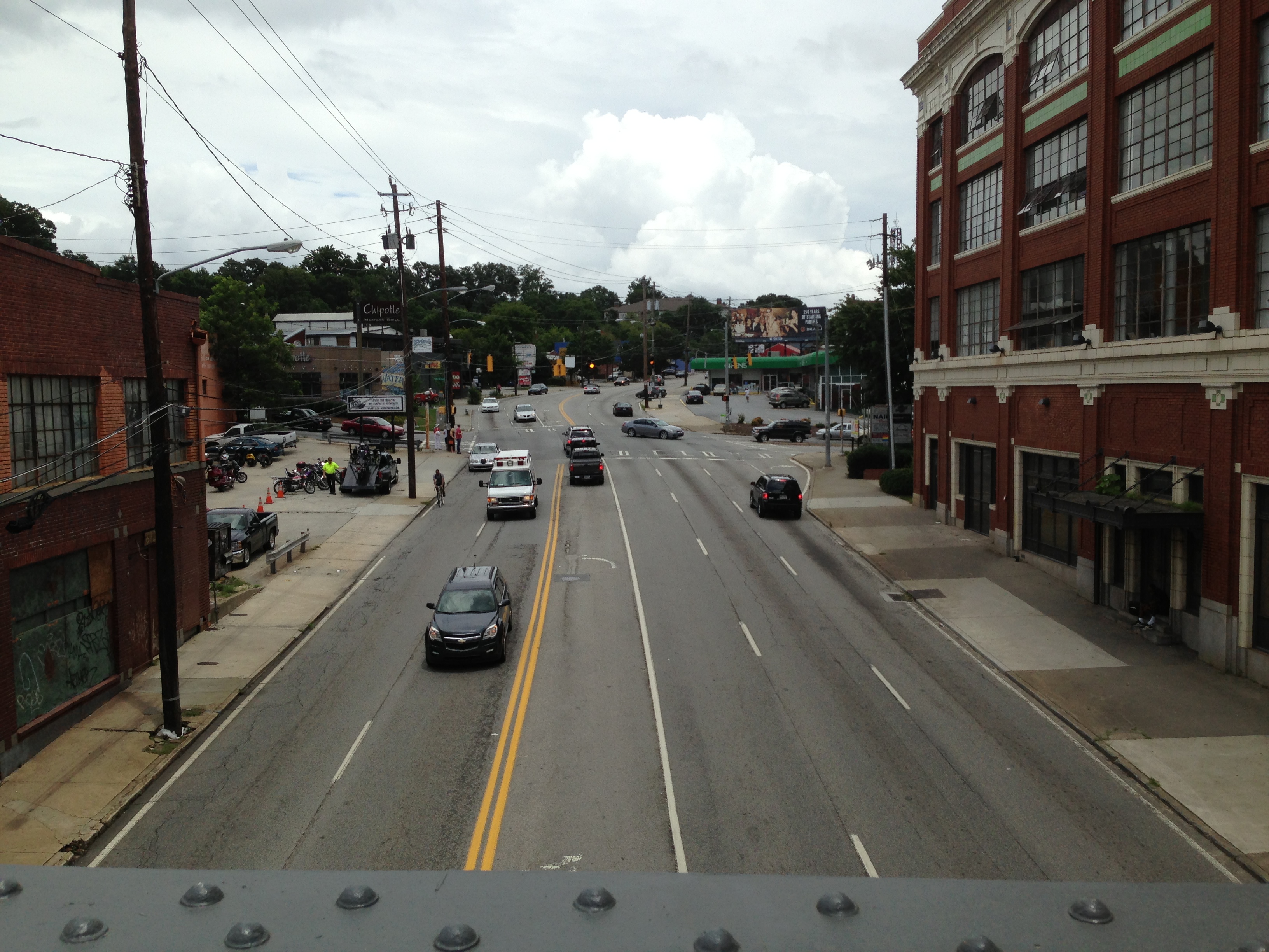
Ponce de Leon Ave poses significant safety issues for all users. Between 2000-2009 there were 5,408 collisions on the 2-mile corridor, resulting in 1,581 injuries and 12 fatalities. It also has the second highest pedestrian crash rate in Georgia.
The posted speed limit throughout the corridor is 35 miles per hour. GDOT’s 2010 average daily traffic counts range from 24,590 – 34,710 vehicles per day. The western extent of the street has seven to eight lanes; east of Ponce de Leon Place has five lanes. The eastern segment carries greater traffic volumes, despite having fewer lanes. There is no continuous center turn lane, and where there is a left turn lane, drivers often must cross three oncoming traffic lanes. Rear-end collisions at intersections are common. In many places, vehicle lanes are only 8.5 feet wide, failing to meet standards, and resulting in sideswipe crashes. Sidewalks are immediately adjacent to the travel lane, with no protective buffer for pedestrians. The narrow traffic lane against the curb floods during rain events, and there are no marked bicycle accommodations. Existing pedestrian safety features include some high visibility crosswalks and lighting to assist with nighttime visibility, but signage is limited and pavement markings are faded.
ROAD SAFETY AUDITS
In early 2011, city transportation staff began coordinating with Atlanta’s pedestrian and bike safety advocacy groups, Pedestrians Educating Drivers for Safety (PEDS) and Atlanta Bicycle Coalition (ABC), to consider a road diet for Ponce de Leon Ave. The group conducted roadway safety audits (RSAs) in late 2011.
The bicycle RSA revealed 11 safety issues, including inconsistency in roadway cross-sections as the number of lanes varies from five to eight, causing confusion and unsafe roadway user behavior. Additionally, high speeds, limited sight distances, and unpredictable road user movements resulted in conflicts at access points and intersections. All reported bicycle crashes on Ponce de Leon Ave between 2003-2007 were angular crashes at intersections; these high-bike-crash intersections also had high numbers of motor vehicle crashes.
The pedestrian RSA identified a number of safety concerns, including aggressive driver behavior, especially when turning at signalized intersections; poor coordination of traffic signals; high driving speeds; and long waits to cross at signals, which require pedestrian activation. Furthermore, crosswalks and curb ramps do not meet Americans with Disabilities Act Accessibility Guidelines, and due to repeated repaving, the curb lacks vertical separation from the road to protect pedestrians from vehicles. In a two-mile segment of Ponce de Leon Ave there are 13 traffic lights and 11 unsignalized intersections. On average, intersections are 436 feet apart and traffic signals are located every 836 feet, a four to five minute walk, compelling many pedestrians to cross mid-block. Between 2000-2008, 133 reported crashes involved pedestrians, an average of 8.3 crashes per year per mile. Of these, 71% occurred at intersections.
Both the pedestrian and bicycle RSAs recommended a road diet to improve safety, as well as the addition of bike infrastructure, vertically buffered sidewalks, and safer pedestrian crossings, including at mid-block bus stops. These reports provided city officials with evidence and recommendations supporting the street redesign. The need for pedestrian refuge islands was also used to justify the addition of the continuous two-way left-turn lane.
PROJECT TIMELINE
As early as 2006, a GDOT-funded pedestrian safety project planned to install HAWK signals and refuge islands where space allowed. In late 2011, after conducting roadway safety audits, the City of Atlanta, PEDS, and ABC were joined by Midtown Improvement District, Georgia Department of Transportation, Atlanta BeltLine, Inc., and Jamestown Properties (owner of Ponce City Market) to form a Ponce de Leon Task Force. The group secured funding and holds quarterly meetings to coordinate the corridor’s four projects: the GDOT pedestrian safety project, a Livable Centers Initiative streetscape and Atlanta BeltLine ramp and stair project, GDOT’s resurfacing project, and a project providing a bicycle and pedestrian connection between Ponce City Market and the elevated section of the Atlanta BeltLine. The four projects collectively total $15 million.
The road diet efforts received crucial top-down endorsement in May 2012 with a letter from the Mayor’s office to Commissioner Golden of GDOT. The letter urged GDOT to reconfigure the roadway for improved safety, noting that Connect Atlanta (the city’s comprehensive transportation plan) and the Ponce de Leon/Moreland Avenue Corridors Study both supported the street redesign. In early 2013, City of Atlanta transportation staff began developing the pavement marking plan with the assistance of GDOT and their consultant. Staff held a series of public meetings, including one for businesses, to collect public input. Businesses were overwhelmingly in favor of the new two-way left-turn lane, and generally viewed the street redesign as attractive. As of summer 2013, the project is under contract; construction began in late summer 2013, and the street redesign is to be completed by early 2014.
COMPLETE STREET RETROFIT
The lane conversion will occur in conjunction with GDOT’s milling/resurfacing project on the two-mile Ponce de Leon Avenue between Juniper Street and Moreland Avenue. GDOT will mill the street to re-establish a curb so the sidewalk and roadway are no longer at the same grade.
West of Ponce de Leon Place, where Ponce de Leon Ave has seven or eight lanes, the roadway will be reduced to five lanes: a two-way left-turn lane, two 10’ travel lanes in each direction, and two 5’ bike lanes with a 2-3’ buffer. East of Ponce de Leon Pl, where Ponce de Leon Ave has three eastbound and two westbound travel lanes, the project will create a two-way left-turn lane with two travel lanes in each direction. This segment of Ponce de Leon Ave lacks space for bike infrastructure, but the parallel St. Charles Avenue will serve as a bike boulevard. The City plans to install a two-stage left turn queue box at the east end of the Ponce de Leon Ave bike lane, guiding bikers to St. Charles Avenue. Working in consultation with MARTA (Metropolitan Atlanta Rapid Transit Authority), the road redesign will relocate many bus stops to the far side of intersections, and will use dashed bike lane markings in bus stop areas. GDOT will also install several HAWK crossings and refuge islands with the pedestrian safety project funded in 2014-2015.
Downloads