Between 2017 and 2026, the City of Austin successfully slowed speeds by 20 miles per hour by prioritizing pedestrian safety on a two-lane road next to a park. After a pedestrian island was installed at the intersection of Springdale Road and Norwood Hill Road, traffic speeds decreased by more than 10 mph on average in both directions. Earlier this year, the city made additional changes that knocked average speeds down by another 10 mph.
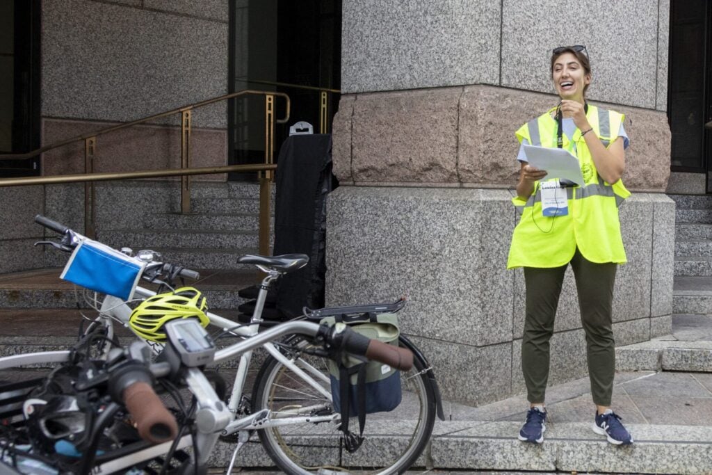
Here’s how city staff used data, equity analysis, and iterative street design to prioritize safety on the busy street in Austin’s East MLK neighborhood.
Background
As a Vision Zero city, Austin is pursuing several efforts to improve pedestrian safety and reduce injuries on their streets, including sidewalk expansion projects, pedestrian crossings, traffic signal improvements, and education campaigns. Since the adoption of the Sidewalks, Crossing, and Shared Streets Plan in 2023, the City has prioritized projects on streets along the high injury network that lie in “focus equity analysis zones.”
Equity analysis zones define areas of the city with higher concentrations of populations that have historically experienced displacement and discrimination, and focus equity analysis zones are the areas that are the most socially and economically vulnerable.
While focus equity analysis zones represent less than 5% of the non-freeway roadway network, nearly 70% of pedestrian serious injury and fatal crashes occur within them. The majority fall on the east side of Austin, which includes many neighborhoods that were once redlined, leaving a lasting impact on the area’s design and infrastructure.
The Springdale and Norwood Hills intersection, identified by the City of Austin in an analysis of gaps in pedestrian crossing infrastructure, falls within one of these focus equity analysis zones and the high injury network.
The Project
Over the past decade, Austin has transformed the busy four-lane Springdale Road, slowing vehicle speeds and making the street safer for people walking and biking.
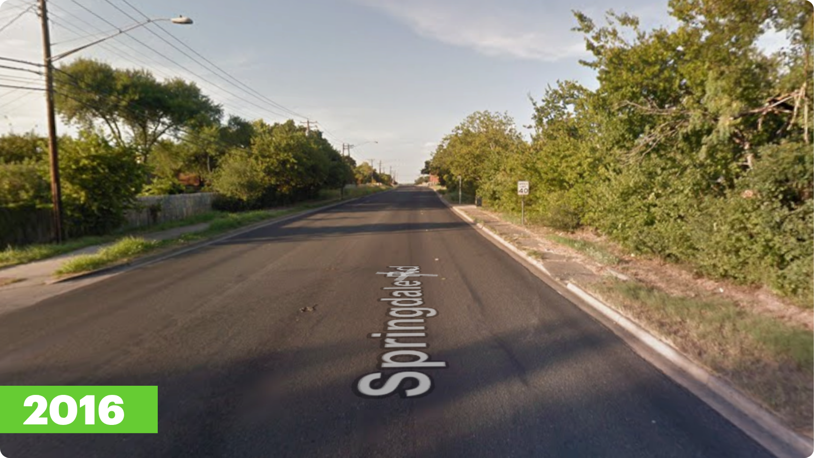
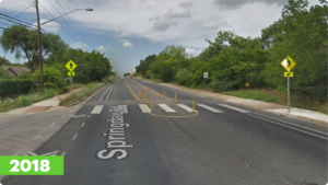
In 2017, the city took the first major step toward slowing down the corridor, reducing the road to two lanes with a two-way left turn lane, adding a paint-and-post island, and striping a bike lane. After this project was installed, speeds averaged around 45 mph.
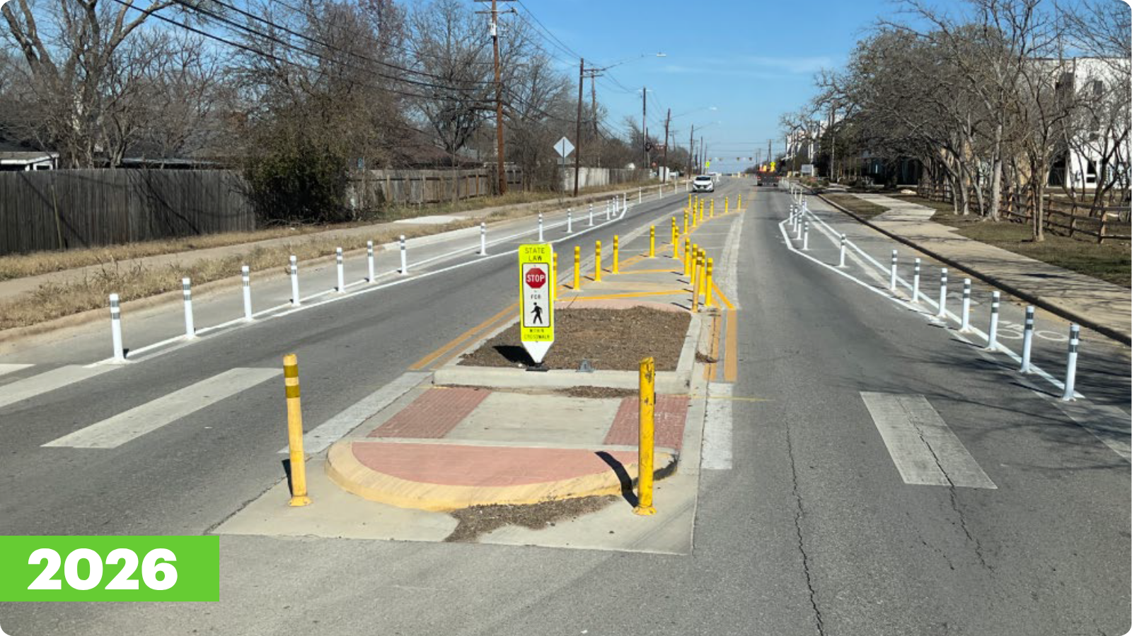
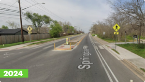
Between 2017 and 2025, the city transitioned the quick build crossing island to concrete and added delineators to the bike lane. This resulted in an average reduction of more than 10 mph in both directions.
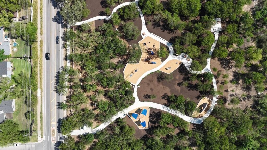
Photo credit: Austin Parks and Recreation Families, Facebook
In the fall of 2025, the city unveiled a new park along this intersection: the Little Walnut Creek Greenbelt. The updated park includes a new playground and a trailhead that connects to more than four miles of informal biking trails. With families and children arriving to access the space, the average speed of 35 mph raised concerns. Since there is no parking immediately adjacent to the park, parents must cross Springdale Road with their children to reach the new play area.
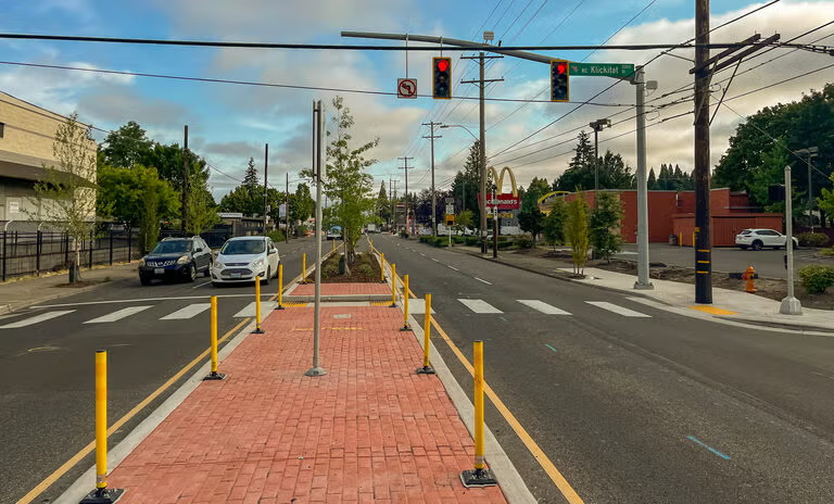
In response to these concerns, the City of Austin took further steps to improve safety at the existing pedestrian crossing island. Earlier this year, the city created horizontal deflection immediately before and after the island, using painted markings and flexible delineators, forcing drivers to shift their paths and reduce their speeds. Prior to these changes, the island was in line with the two-way left turn lane. With this change, speeds decreased by another 10 mph on average, to 25 mph northbound and 19 mph southbound.


This project is a part of a series of roadway redesign projects down the Springdale Road corridor, including a redesign of the MLK and Springdale intersection, which saw 77 crashes between 2019 and 2023. The redesign shifted the five-way, signalized intersection to four lanes, added a pedestrian crossing island, and improved connectivity to protected bike lanes.
Lessons and Next Steps
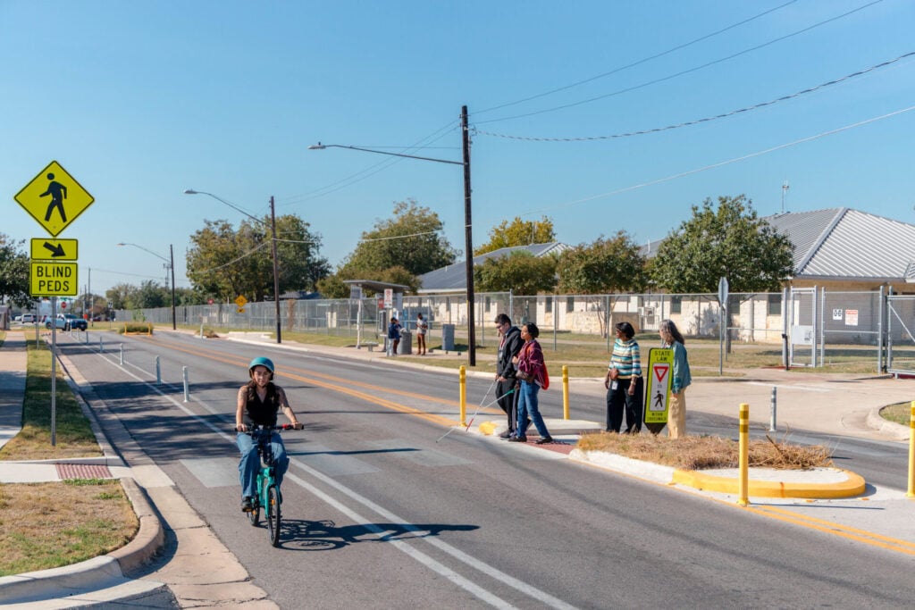
Photo credit: Austin Transportation and Public Works, Flickr
Speed plays a critical role in roadway safety for all users: as vehicular speeds rise, crashes are more likely to occur, and when they do, they’re more likely to be deadly. And street design plays a critical role in how fast motor vehicles travel. Because many streets have been designed in ways that entrench economic and social inequities, certain neighborhoods have more roads designed for high speeds and suffer a disproportionate amount of traffic-related injuries. Austin’s equity analysis zones demonstrate how data can be used to prioritize traffic calming projects in the areas of highest need and lowest historic investment. Encouraging slower speeds through street design is a key contributor to a safe, accessible, pedestrian-friendly roadway.
Among the tools cities have at their disposal, pedestrian crossing islands and other crossing improvements bolster pedestrian safety where conflicts are most likely to occur on multilane, high-traffic corridors. These treatments improve visibility for both drivers and pedestrians, especially when these islands are made visually distinct using hardened curbs or flexible delineators.
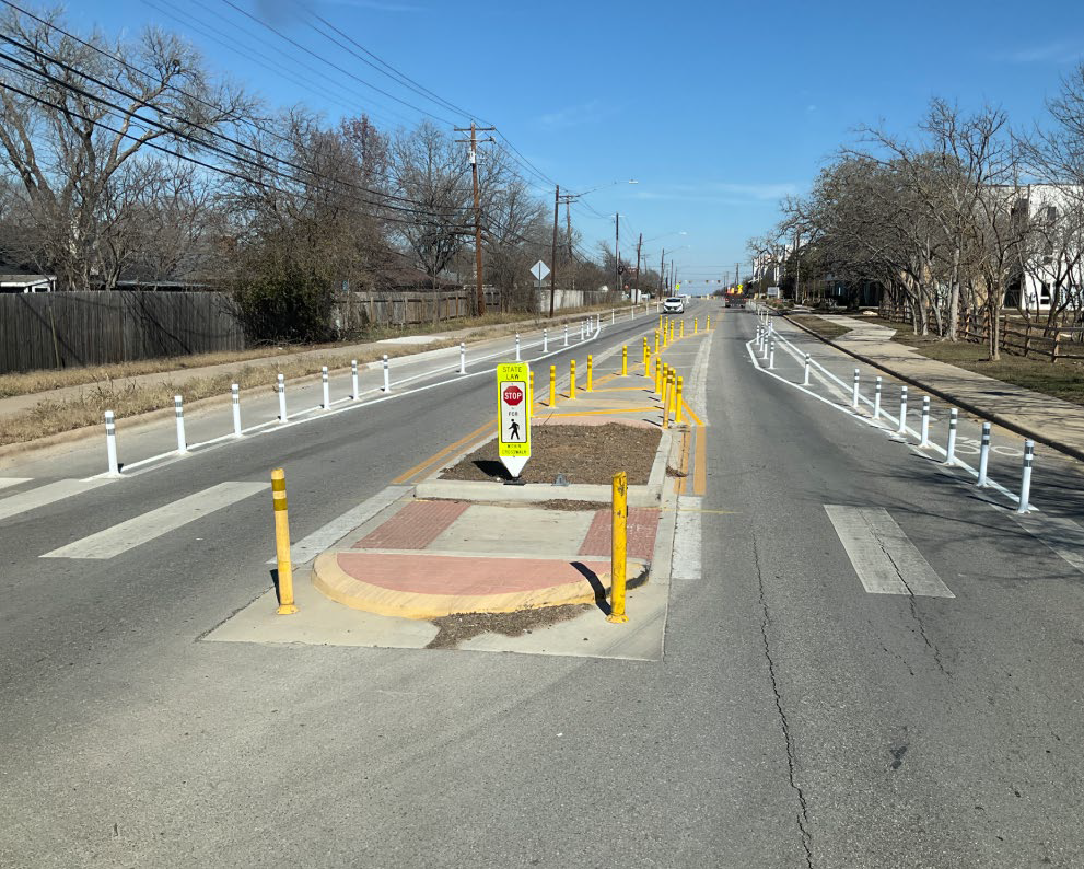
In Austin, using additional striping and flexible delineator posts to create a chicane-like narrowing of the travel lanes has greatly improved speed mitigation and yielding compliance at crossing islands. In urban environments, Austin has also found success using a design speed lower than the posted speed for tapers, alongside an advisory speed plaque ahead of the pedestrian crossing. Since 2017, the city has installed 35 pedestrian islands on about 4.25 miles of Springdale Road at all-way stops and signals.
The result of this series of improvements illustrates the effectiveness of traffic calming measures when intersections are assessed as part of a network, rather than in isolation. Across the city, Austin’s Vision Zero analysis shows that installing pedestrian crossing islands reduces serious injury and fatal crashes by 27%, and saves the city $17 million per year in crash-related costs. These early wins promise even greater improvements ahead as new projects transform the corridor into a safer, more vibrant place for everyone.